

The Kyrgyzstan Ala-Too Trail (KAT) is the first established national trail in Kyrgyzstan, ranging from the region of Chuy, through Naryn and on to the Issyk Kul region.


We anticipate that the Kyrgyzstan Ala Too Trail will draw thousands of visitors each year and inspire even more to plan future visits as the trail develops as an environmental conservation and outdoor recreation natural resource.
Read more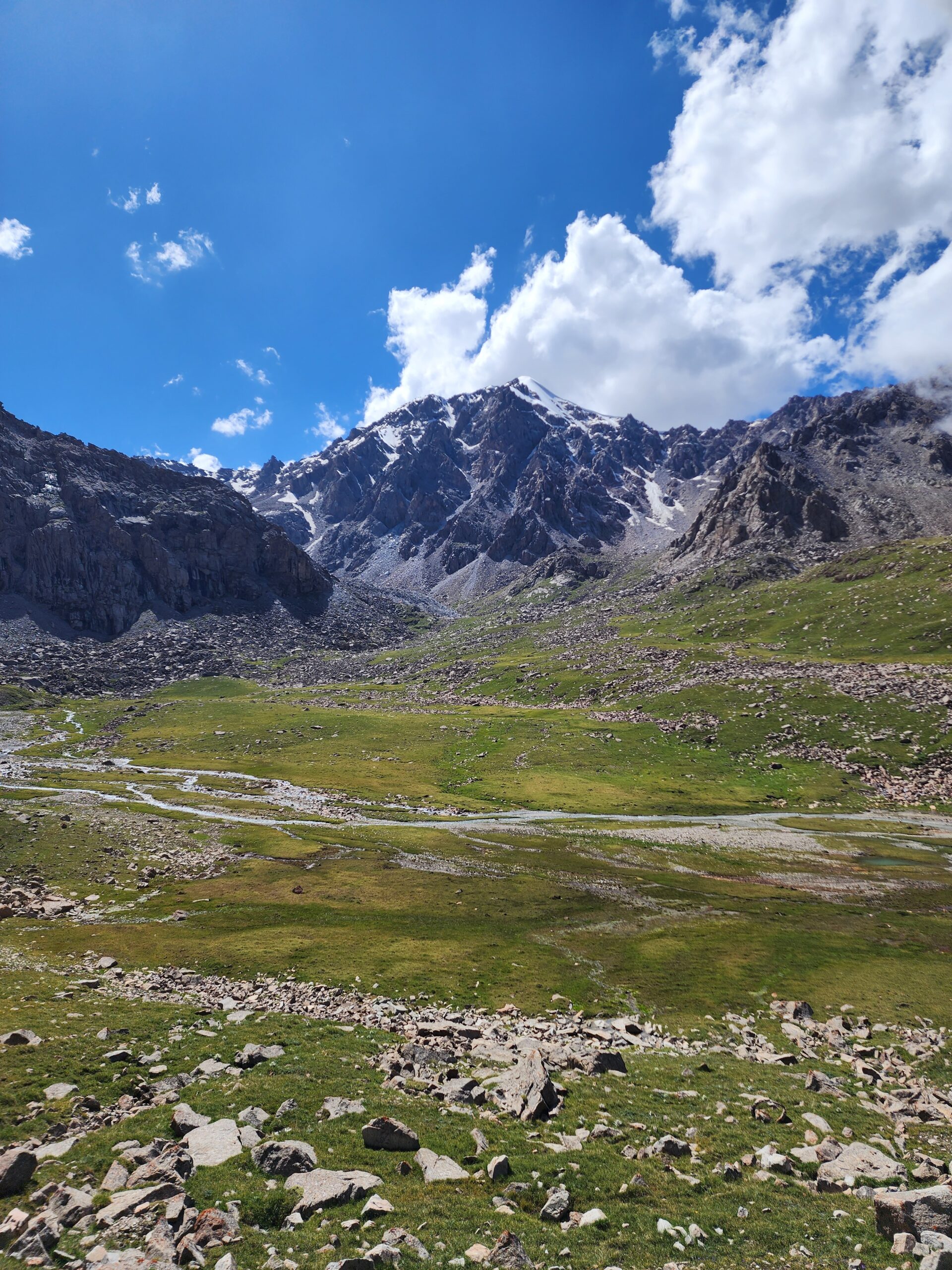
When hiking in the mountains of Kyrgyzstan, you should be aware of the risks of avalanches, landslides, and rockfalls. You should also be prepared for sudden weather changes and heavy snowfall.
Read more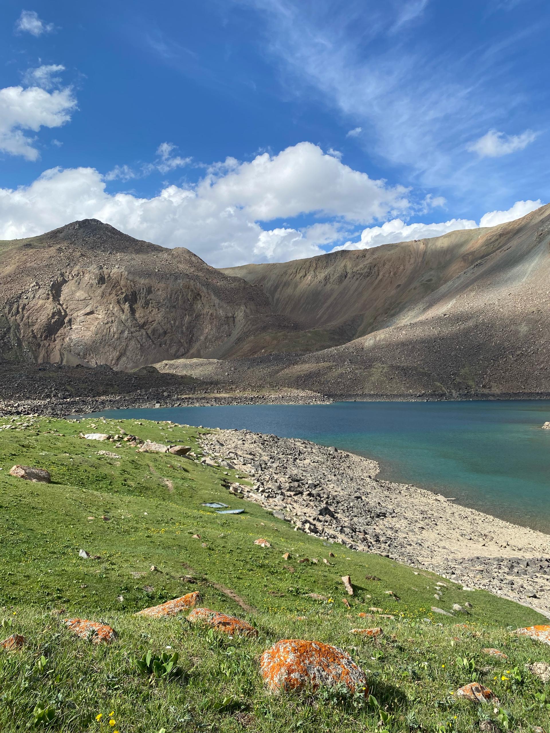
The equipment, clothing and footwear you will need depends on the season and the length and location of your hike.
Read moreTransfer to Bishkek.
Transfer
Distance: 110 km
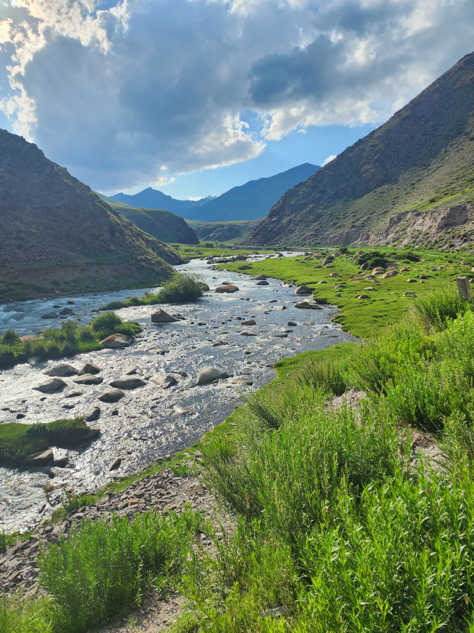
The trek starts in the Kegety Gorge, about 80 kilometresfrom Bishkek. The gorge is famous for its rich flora and fauna, the turbulent Kegety River and green meadows surrounded by the majestic Tien Shan Mountains. The trail climbs gradually, offering magnificent views of the gorge. The pass is about 3,800 metres above sea level. The climb requires some physical preparation as the road becomes steeper and the climate harsher. The pass is a picturesque place with panoramic views of the surrounding mountains and glaciers. From here you can see the massifs stretching far beyond the horizon. Dinner and overnight in a tent below the pass.
Distance: 12 km
After breakfast we descend to the Karakolka River. The descent will be slow as it is very steep and rocky. On the way you will meet local shepherds and cyclists. We spend the night at the Karakolka River.
Distance: 11 km
The morning starts with crossing the Buchuk -Bel Pass 3600m. Descent to the campsite. Dinner and overnight stay.
Distance: 16 km
Today’s route is flat, passing Kichi-Sandyk Zhailoo and the Sok Valley. Here you can see the loon or red duck, a water bird of the duck family related to the pegan. In Kyrgyz it is called Anyr. Overnight in a yurt before the Kok-ZharPass.
Distance: 16-18 km
The morning starts with a climb to the Kok-Zhar Pass 3600m. In good weather, the pass offers stunning views of the mountains. There is a chance to see part of Lake Son-Kol. After a short rest we descend to the Oktorkoi valley. Dinner and overnight in the valley.
Distance: 12 km
Today you will walk through the Ok-Torkoy valley. You will see the valley where local herders graze their cattle in early spring and late autumn. Today will be an easy day. You will see the valley where local herders graze their cattle in early spring and late autumn. Today will be an easy day. Camp will be set up at Oktorkoy Zhailoo.
Distance: 10 km
After breakfast you will reach Kyzart pass along the plain. Overnight in the camp before the pass.
Distance: 13 km
Your trek will take you through the sacred Baba Ata mountain, which is 4400 metres high. On the way, you will also come across a river in the Chaar Archa valley. Here you have to cross the Chaar Archa pass at an altitude of 3061 metres. After lunch, you will arrive at Kilemchefor the night.
Distance: 13 km
After breakfast in Kilemche-Jailoo – the name means ‘like a carpet’ and this grass canvas covers entire mountain ranges, shimmering like each shyrdak (shyrdak is a Kyrgyz felt carpet) – follow the trail through green hills to Son-Kol Lake. Dinner and overnight in a yurt, of course.
Distance: 11 km
Today you will hike along the northern shore of Lake Son-Kol. On the way you can see the local flora and fauna. This place is very popular with both tourists and locals. Dinner and overnight at camp.
Distance: 13 km
Here the walk becomes a little easier and you can enjoy the peace and quiet of nature and the open spaces. The trail becomes less and less difficult. Dinner and overnight in camp.
Distance: 17 km
After breakfast, the trail passes through pastures where you can see traditional Kyrgyz yurts. These areas are characterised by gentle slopes and green fields with grasses, flowers and rare plants. In these places you can also see shepherds with sheep and goats. During the trek you will have magnificent views of the surrounding mountain peaks and valleys. Dinner and overnight in tents.
Distance: 18 km
In the morning, after breakfast, the route passes through picturesque mountainous areas. Kumbel Jailoo is a pasture surrounded by green hills and mountains. Here you can see nomads with their yurts and grazing animals. The start of the trail follows a gentle valley along a small river. After the climb, wide meadows open up with views of snow-capped peaks. Here you can take a break and enjoy nature. The final climb to the pass is quite steep and rocky. At the top of the pass you can enjoy the breathtaking views of the surrounding mountains and valleys.
Distance: 12 km
As you move up the slope, you will find yourself in the alpine meadows that are typical of the high mountains. These areas are often covered in bright green grasses and flowers, and shepherds with sheep and goats can often be seen. Traditional Kyrgyz yurts can be seen in the meadows, where shepherds live and graze their livestock during the summer. It is important to take care when trekking as the high altitude pastures can be slippery and difficult to cross in places. Overnight and dinner at camp.
Distance: 15 km
After breakfast the trek begins. This area is rich in wildlife – rare species of plants and animals such as mountain goats, maral and various species of birds. These valleys offer beautiful views of the snow-capped peaks that gradually appear in the distance. This part of the trek can be very relaxing. Overnight and dinner at camp.
Distance: 18 km
Today you will cross mountain streams and rivers that can be waded or crossed by stone bridges. The KarakujurRiver, along which the route passes, is famous for its turbulent waters and beautiful waterfalls, which create a dynamic atmosphere and complement the scenic views. These rivers are not only an important natural feature of the route, but also a kind of landmark for travellers. This area is also important to the local herders and their camps are sometimes found near rivers and meadows. The area around the river is scenic and peaceful, with beautiful views of the surrounding mountains. Set up camp and spend the night in a tent.
Distance: 16 km
The route passes through alpine meadows and grassy clearings – a relatively easy section of the walk. From here you can enjoy views of the surrounding peaks and small waterfalls cascading down the slopes. You will pass through rocky sections with steep climbs and descents. These sections require care and attention as the rocks can be slippery, especially after rain.
Distance: 18 km
In the morning we drive to the valley of the Korumdu-Suu river, an important waterway in the region. Here tourists can enjoy the silence of nature, listen to the murmuring of the river and be surrounded by picturesque landscapes. At first, the route follows the river through open spaces with green meadows and forests. This section offers beautiful views of the surrounding mountain ranges and rugged cliffs. There is a good chance of seeing local wildlife such as wild goats and deer. Dinner and overnight at camp.
Distance: 17 km
After breakfast you will walk along the river on soft and grassy slopes, making the crossing quite easy. There are small forests and bushes along the way and rare wildlife such as maral, wild goats and eagles. These sections are an opportunity to relax and enjoy the spectacular views of the surrounding peaks and valleys. Set up camp on the Kara Goman River.
Distance: 18 km
The route from the Kara Goman River to the Teshik Pass passes through picturesque highland areas. It is characterised by a variety of landscapes, from river valleys to mountain plateaus and steep passes. The section along the river begins in a picturesque valley. The water in the river is usually cold and clear, with a fast current. Vegetation becomes scarcer and rocky areas appear. The trail becomes steeper and more winding. Teshik is at a considerable altitude (about 3500-3700m, the exact altitude depends on the region). The path to the pass passes through steep slopes. The pass offers magnificent views of the surrounding mountain ranges. Dinner and overnight at camp before the pass.
Distance: 12 km
In the morning we climb up to the Teshik Pass where we have a beautiful panoramic view of the mountains. After a short rest we descend to camp at the mountain lake. Rest and overnight.
Distance: 10 km
Lake Teshik is situated in a high mountainous area surrounded by ridges. It is famous for its crystal clear water. After the pass you start to descend into the Uch-Emchek valley. Uch-Emchek is known for its remoteness and pastoral landscape with vast steppes surrounded by mountains.
Distance: 12 km
After breakfast we leave the Uch-Emchek valley. We follow the Dzhily-Suu river, which rises from the Kokuy-Kol lake. We spend the night in the Kerege-Tash valley.
Distance: 18 km
Today we climb to the Kerege-Tash valley. From the top you can see beautiful mountain ranges. After a short rest, we descend to the Kerege-Tash gorge. Here we will set up camp for the night.
Distance: 15 km
Today we enter the Kerege-Tash valley and climb all day. Our route will be easy. Today we will stop before the ascent to the Dunguromo Pass.
Distance: 13 km
We spend the day crossing the Dungurumo Pass, which is at an altitude of 3,800 metres. This is truly a wilderness where not even shepherds live. Thanks to this you will have the chance to see wild animals such as Marco Polo sheep, golden eagles, marmots and many others. After crossing the pass, we will spend the night in a jailoo(summer pasture).
Distance: 12 km
It’s going to be an easy ride today. No mountain passes to cross. You will admire the beauty of the Djuku Valley. Dinner overnight.
Distance: 10 km
The Djuku Valley is surrounded by forests, mountain peaks and glaciers. Many herders live in this valley with their cattle and you will have the opportunity to experience their way of life. We spend the night in this valley by the river.
Distance: 10 km
Today you will cross a pass at an altitude of 3,641 metres. It is called Ashuu-Tor and is famous for its fantastic panoramic views. Then you will descend to the Kyzyl-Suu valley where you will camp.
Distance: 10 km
Today you will hike along the Chon Kyzyl-Suu gorge. You will admire the high Karagay. There will be no climbing today. We will stop for the night by the river and set up camp in the Kyzyl-Suu valley.
Distance: 10 km
After breakfast we start the ascent to the Archator Pass (3890m), the ascent starts directly from the camp and is an active ascent. Here we will relax and enjoy the panoramic view of the mountains. Then we descend to the Zheti-Oguz valley. Dinner and overnight at camp.
Distance: 11 km
After breakfast we climb up to the Teleti Gorge where we set up camp before the pass.
Distance: 12 km
After breakfast we cross the Teleti Pass (3800m), the first part of the walk is only to the top of the pass, we rest here and then descend to the Karakol National Park. We will set up camp there.
Distance: 10 km
We leave early in the morning for Ala-Kol Lake and Sirota Gorge. In summer this trail is very busy and many trekkers stop at Sirota Gorge. Overnight in a camp near the lake.
Distance: 9 km
We start by crossing the Ala-Kol Pass (3860m). From the top we have a beautiful view of the Ala-Kol lake and the Tien Shan peaks. We descend along the Keldike gorge to the Altyn-Arashan valley. Overnight stay and dinner in camp.
Distance: 10 km
After breakfast, we cross the Ortok Pass at an altitude of 3,600 metres, with breathtaking views of the mighty Tashtanbek Tor Bashi. This is a pyramidal peak and the view is simply mesmerising. From the pass we descend into the famous Aksuu Gorge, where we stop to rest among the beautiful mountain peaks.
Distance: 11 km
Our route goes through the Ailanysh Pass, which is 3670 metres high, we have already crossed several passes and this pass will be the highest, we will have a breathtaking panorama of the Kashka Suu Glacier, we will descend to the Jergez Valley.
Distance: 12 km
After breakfast we set off for the Bozuchuk Gorge, we have to cross a 3500 metre pass with steep ascents and descents, our camp will be at an altitude of 3000 metres.
Distance: 12 km
Today we cross the Boz-Uchuk Pass and spend the night in the Turgenaksuu Gorge. It is hard to imagine that in winter these places are covered in a thick layer of snow and you can go freeriding here.
Distance: 11 km
After breakfast we cross our first pass on this route, the top of the pass is at an altitude of 3500 metres, then we descend into the amazingly beautiful Terim Tor Gorge where we set up camp. The gorge is very picturesque and is used as a summer pasture by cattle breeders.
Distance: 8 km
Today we head to the village of Jyrgalan. A warm welcome awaits you in the evening at the guesthouse, where you can take a shower and have dinner.
Distance: 11 km


